


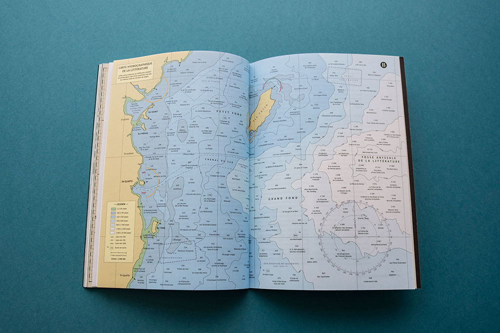
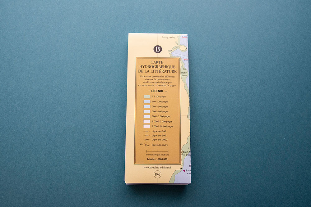
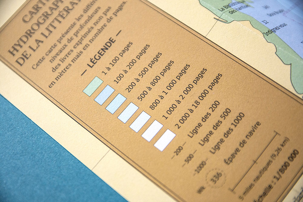
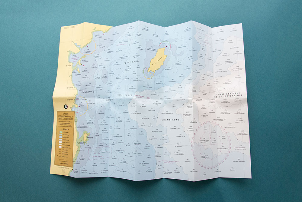
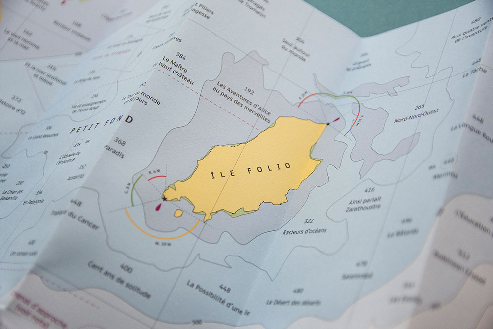
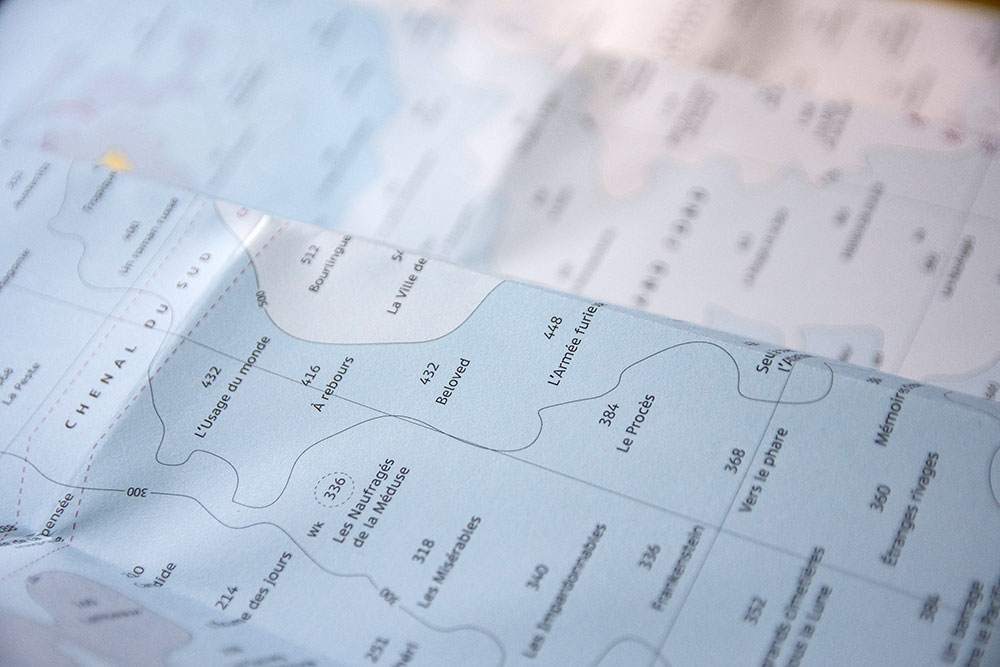
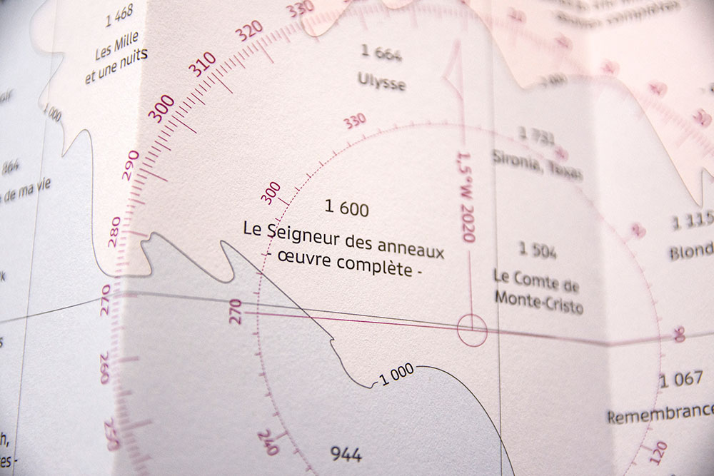
Hydrographic map of the literature
Design of a hydrographic map of the literature which presents the different depth levels of books expressed not in meters but in number of pages. Previously published in number 3 of the Bouclard review to illustrate Fabrice Chillet's article: Sailors can read too. Available in bookstores and on the Bouclard ûˋditions website.
Format 9.4 x 23.5 cm closed, 47 x 65.8 cm open / 6 accordion folds + 1 cross fold / Printed in France by Allais on Fedrigoni paper / Photos: papierplie


ô
ô
ô